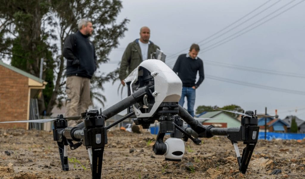
There’s a lot of conflicting information about where job opportunities are in the future. The drone industry is one that’s getting a lot of press and for good reason! There is so much talk about all the different sectors of the industry that it’s easy to get lost in the flood of information. The information below will provide you with a clear picture of the industry and where the opportunities lie.
The number of companies employing professional drone pilots is doubling each year. This growth is in sectors such as drone photography and videography, real estate, industrial inspections, 3D mapping, surveying, emergency services, scientific research, agriculture and environmental monitoring. We are also seeing a massive growth in the support industries such as maintenance, manufacturing, regulation, software development and research and development with drones.
Hype or Reality?
You’ve probably heard all the hype about the sky being full of drones and every company is scrambling to get drone pilots. Unfortunately, this isn’t entirely correct, while there are lots of companies hiring pilots, like any job, you have to show that you can do the work. A showreel is the best way to prove what you can do and what kind of product you can produce. This showreel needs to be able to highlight your skills so, make sure it’s some of your best work, if you can do visual effects, highlight that fact. This showreel can be accompanied with a making of video which can be part of a video resume.
To increase your chances of getting employed you need to be trained properly and then follow up that training with continued professional developments and actually flying the drone.
The Sectors
As we’ve said there are many sectors in the drone industry and it’s important to target only two or three when you are operating professionally. Here is an outline of each sector painting a clear picture of the sector and the best way to get into it.
Drone photography and videography
Quick Look
| Complexity | [usr 4] |
| Competition | [usr 7] |
| Pay | [usr 5] |
| Opportunities | [usr 7] |
Services Industries
- Real Estate
- Events
- Corporate Videos
- Property Development
- Documentaries
- TV Shows
- Movies
Overview
The photography and videography industry is the most popular and exciting sector of the drone industry. There are countless new and exciting opportunities for professional UAV pilots in photography and videography. In particular the real estate and events industries which have widely adopted the use of drones for taking the perfect photo or creating a truly special video. As you can imagine, this work can sometimes be competitive so it’s important to be able to show what you can do. As we talked about above, a showreel is a must have for any professional drone pilot. The uncertainty of what drones can do will make a lot of potential clients hesitant about shelving out the big bucks to hire you, so being able to show them what they can expect is a great way to win jobs.
Skills
Being a highly competent pilot is very important here as it is in any sector however ensuring that you can plan your flight path to be able to get the shots you want is a very valuable technique. Other skills like editing are highly valuable in this field as is any experience with traditional video or photography. A good way to boost your skills in this sector is to take a course in editing as well as photography and videography, this can be online or in person.
Industrial inspections
Quick Look
| Complexity | [usr 8] |
| Competition | [usr 6] |
| Pay | [usr 8] |
| Opportunities | [usr 7] |
Services Industries
- Mining
- Engineering
- Surveying
- Oil & Gas
- Construction
- Transportation
- Basically, any industry that has assets
Overview
Industrial inspections describes any job where you are taking images of an object with the goal to evaluate that object. We see a lot of demand for this type of work from larger organisations. The main advantage of getting into this type of work is that there are a lot of well paying opportunities out there. However, the reason this work is highly paying is that can be very complex. The art of taking photos so they can be effectively presented and interpreted is something that has to be learnt through experience. At the end of a large job you may have thousands of photos and unless you have taken them in the correct order and stored them properly, they are essentially useless.
Therefore, to build up your capability in this area, set up trial jobs and run them through from start to end. Create a fake client and scope, plan the mission fully, conduct the mission and then deliver the data like you would to a potential client. Continue to do this until you are happy that you can produce an excellent quality product reliably.
Skills
Success in this industry relies on your ability to be able to prove your ability. Large companies hate risk but they aren’t scared to pay well as long as they are confident that they will get what you are promising. The best way to give them the security they want is to show them what you’ve produced in a portfolio. This portfolio will help you demonstrate the different types of inspections you can do. A good thing to keep in mind is to include some of the challenges that you faced in those jobs and then explained how you overcame them. This helps to show that you are capable of identifying and solving problems as they occur.
3D mapping
Quick Look
| Complexity | [usr 8] |
| Competition | [usr 6] |
| Pay | [usr 8] |
| Opportunities | [usr 6] |
Services Industries
- Mining
- Environmental Monitoring
- Surveying
- Energy
- Telco
- Infrastructure Management
Overview
3D Mapping is one of the most valuable applications for UAV technology from an enterprise point of view. It is incredible in its ability to take hundreds of gigabytes of information and convert it into an incredibly useful and explorable form.
Skills
Specialising in 3D drone data capture generally involves expertise in multiple areas including planning, risk assessment, data capture, data processing and delivery. Mapping missions require a lot of planning, this is due to the fact that most missions you will be able to conduct autonomously. This planning stage leads directly into risk assessment, this needs to be done before and during the operation. Mastering this step is crucial to ensuring that you can reliably complete every job. Data processing and delivery are often the most complicated parts of a 3D mapping job, fortunately they are the most valuable. The reason why this part of the process is so complicated is because you need to present the data in a way that the computer can properly interpret it. If your organization can master all of these components then you can present potential clients with a hugely valuable product.
Surveying
Quick Look
| Complexity | [usr 9] |
| Competition | [usr 4] |
| Pay | [usr 8] |
| Opportunities | [usr 8] |
Services Industries
- Surveying
Overview
This sector is the combination of 3D mapping and industrial inspections and utilises many different technologies to create highly valuable and complex surveys of areas. This application is so complex it utilises highly sophisticated equipment and processes. It is possible to split this type of job between a team of people or multiple companies. Our sister company Airsight Australia works with multiple surveying companies to successfully complete the more complex jobs.
Skills
The skills required to complete these types of jobs vary massively in complexity. From a drone operations point of view, it is not that different from the of industrial inspections however that data processing side if much more complex. To get the still in surveying that you would need there are a wide range of courses available from CERT III to bachelor level.
Emergency services
Quick Look
| Complexity | [usr 6] |
| Competition | [usr 7] |
| Pay | [usr 6] |
| Opportunities | [usr 5] |
Services Industries
- Fire
- Police
- Search and Rescue
- Damage Assessment
Overview
The emergency service sector is one that started growing rapidly since the beginning of 2016. We have had overwhelming interest from emergency services like the SES and Police to help integrate drone into their operations. This presents a unique opportunity for companies to help the emergency services use drone and teach them what they can and can’t do as well as help them if they’re in high demand.
Skills
Being involved with emergency services will help here. The emergency services industry has huge potential for drone technologies so making sure you are able to customise the technology and processes for each specific situation is important. Industry experience will benefit you greatly in this industry as this will provide you with exposure to a lot of different applications utilising drones.
Scientific research and environmental monitoring
Quick Look
| Complexity | [usr 10] |
| Competition | [usr 7] |
| Pay | [usr 6] |
| Opportunities | [usr 6] |
Services Industries
- University research project
- Environmental monitoring
Overview
This use on the technology forms one of the most exciting, challenging and complex sectors of the RPAS industry. Working in the scientific research sector of the industry can involve responsibilities such as building and maintaining custom airframes as well as building, mounting and maintaining custom payloads. These payloads expand far beyond the reaches of simple cameras. Our graduates have gone on to work with researchers to integrate gas and lidar sensor to UAVs to name a few.
Skills
This application for drones can be quite complex and generally requires an in depth knowledge of the technology. This doesn’t mean that you can’t get into this sector without that knowledge. Most of the knowledge required to be successful in this industry is gained through working, this means that the best way to get into this sector is to start small. After getting qualified to fly commercially the next step would be to get in contact with various RPAS companies to see if you can help them on any research and development projects.
Agriculture
Quick Look
| Complexity | [usr 6] |
| Competition | [usr 5] |
| Pay | [usr 6] |
| Opportunities | [usr 7] |
Services Industries
- Farming
Overview
While this sector seems very specific, it is one of the fastest growing and most exciting parts of the RPAS industry. This is due to the huge advantage that drones provide to the industry. From an information gathering standpoint, drones are able to gather almost limitless information about a property. From health on crops through NDVI images and checking on livestock, to inspecting the perimeter and creating 3D maps for planning and inspection. Not only can you gather valuable data easily, you are now able to interact with the farm. There are many spraying drones out there that are incredibly useful for accurate spraying and spraying in areas that are hard to reach. We have talked to people that have used drones to scare birds from paddocks and some are even trying to herd cattle with some success!
Skills
The skills required to operate in this sector are diverse and can be very basic for things like data collection. Valuable insights can be gained by using small drones with software packages such as drone deploy, however, you still need to fly safely. Moving up to the spraying drones, these can weigh upwards of 20 kg and can be very dangerous. To maintain and operate a drone of this size, you need to ensure that you have the experience and knowledge to do so. This is generally gain by doing type training on that specific airframe.
If you are interested in finding out more about UAVAIR’s training courses you can get in contact with a drone expert on 1300 893 340.